Weather in Canberra: Forecast, Temps & Climate Guide
Canberra’s inland plateau altitude—570 meters above sea level—makes its nights 5–8°C colder than coastal Sydney year-round. The city records four genuine seasons, with July averaging 0.0°C at Canberra Airport per official Bureau of Meteorology data. This guide walks you through current conditions, seasonal patterns, and what to expect when planning a visit.
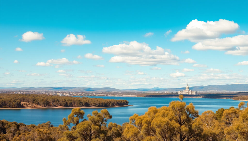
Current Temperature: 55°F · Conditions: Rain shower · Wind: Moderate breeze · Forecast Highlight: Rain Thursday · Sun Protection: Recommended from 10:10
Quick snapshot
- July is the coldest month with mean min 0.0°C at Canberra Airport (Bureau of Meteorology)
- November records 64.5 mm rainfall, the wettest month (Tourism Australia)
- Long-term climate change impacts on seasonal patterns remain under study
- Regional variations within ACT not fully quantified in available data
- Summer 2026 recorded coolest-ever average of 6.7°C at Canberra Airport (Bureau of Meteorology ACT Summary)
- December 2, 2023 saw -0.3°C at Canberra Airport—coldest summer start on record (Region.com.au)
- Check BOM 7-day forecast for current conditions and upcoming weather systems
- Rain likely Thursday; spring storm season brings increased thunderstorm activity
What is the coldest month in Canberra?
July consistently delivers Canberra’s most bitter cold. Official BOM data shows the mean minimum temperature at Canberra Airport drops to 0.0°C, with daytime highs struggling to reach 11°C on average (Bureau of Meteorology). Compare that to January, when overnight lows average 13.6°C—clearly the thermal divide between seasons is dramatic.
Average lows
Tourism Australia reports winter temperatures generally range from 1–12°C, with nights frequently below freezing (Tourism Australia). WeatherSpark confirms July averages a low of 34°F (1.1°C) and high of 52°F (11.1°C)—figures that underline why layering matters if you’re visiting mid-year.
Canberra Airport runs consistently colder than city-center sites. If you’re checking Tuggeranong or other suburban stations, expect readings 1–2°C milder than the official airport figures.
Historical records
The all-time cold record stands at -10°C, recorded in July 1971 (Climates to Travel). More recently, December 2, 2023 brought an extraordinary -0.3°C at Canberra Airport—shattering the previous December low of 0.3°C set in 2012 (Region.com.au). That event broke a 59-year record dating back to 1964.
What this means: even summer months carry a frost risk at Canberra Airport. Visitors landing early December should pack a light jacket—not just sunscreen.
What is the best month to visit Canberra?
The sweet spot for most travelers is autumn (March–May) or spring (September–November), depending on what you prioritize. Autumn delivers temperatures averaging 6.8–20°C with fading rainfall, making outdoor exploration comfortable (Tourism Australia). Spring, however, draws visitors specifically for the Floriade festival and blooming gardens.
Spring warmth
September temperatures climb to an average 6–19°C, with rainfall ramping up: September sees 52mm, October 62mm, and November peaks at 64.5mm (Tourism Australia). November also records the most rain days—roughly 10–12 per month—meaning you’re trading warmth for bloom at a soggy cost.
Autumn mildness
TradeHub Visit Canberra describes autumn as offering pleasant mildness without the spring rain spikes (TradeHub Visit Canberra). If you’re planning outdoor events, weddings, or sightseeing without weather-related logistics, March through May generally outperforms September–November.
Tourism Canberra actively promotes September for flower season, but the data shows November’s rainfall nearly 25% higher. Pack accordingly—or consider October as a middle ground with warmer temps and less precipitation than November.
Why is Canberra so cold at night?
Canberra’s nighttime chill comes down to two geographic factors: elevation and location. Sitting 570 meters above sea level on an inland plateau, the city lacks the coastal ocean moderation that keeps Sydney’s nights milder (TradeHub Visit Canberra). Clear winter skies then act as a radiator, releasing absorbed heat rapidly after sunset.
Elevation factors
Higher elevation means thinner air and faster radiative cooling. Canberra Airport’s official station regularly logs lower temperatures than suburban sites precisely because the open airfield exposes instruments to unobstructed nighttime radiation. Frosts are common in winter, particularly in low-lying suburbs surrounding the valley.
Inland position
Unlike coastal cities, Canberra doesn’t benefit from the ocean’s thermal storage capacity. Summers are warm but dry; winters are cold with low humidity. TradeHub notes that Canberra has low humidity, dry summers, and cool winters—a combination that accelerates nighttime cooling (TradeHub Visit Canberra). Even in summer, clear nights can drop below 15°C.
What is the rainiest month in Canberra?
November is Canberra’s wettest month, averaging 64.5 mm of rainfall (Tourism Australia). Spring—not summer or winter—carries the highest precipitation burden, driven by weather systems moving east across the continent.
Monthly averages
Tourism Australia’s data shows a clear ramp-up: September averages 52mm, October 62mm, and November peaks at 64.5mm (Tourism Australia). In contrast, winter months drop to 40–46mm monthly rainfall, while summer sits at 54–59mm per month. The pattern isn’t about total volume—it’s about frequency: November records the most rain days, roughly 10–12 per month depending on the source (Bureau of Meteorology).
Seasonal patterns
BOM historical data confirms rain days peak in spring months, with July 2006 recording 47.6 mm over 12 rain days (Bureau of Meteorology 2006 Summary). That said, July’s lower temperatures mean less atmospheric instability, reducing the thunderstorm risk that characterizes spring rain events. Summer storms can bring intense bursts, but spring’s steady drizzle often spans more days.
November brings the most rain days but not necessarily the most rain hours per event. A spring visit in October offers a balance: warmer than November, with less than half the rain days expected.
Canberra Weather Forecasts
For real-time and short-range forecasts, the Bureau of Meteorology remains the authoritative source. Their 7-day outlook, hourly updates, and radar imagery cover the ACT region directly, including Canberra Airport and ACT Mount Ginini AWS stations for regional context.
7-day outlook
BOM’s 7-day forecast for the ACT region updates continuously, showing daily high/low ranges, precipitation probability, and wind conditions. The current snapshot shows a rain shower with a moderate breeze, with rain returning Thursday. Temperature spreads typically run 8–12°C between daily highs and lows in spring/summer, widening to 10–15°C in winter.
10-day extended
Extended forecasts carry higher uncertainty, particularly for precipitation details beyond 5 days. AccuWeather and WeatherSpark offer 10-day outlooks calibrated against BOM data, though the primary source for ACT-specific alerts remains the Bureau.
Radar and tomorrow
BOM’s radar loop covers the ACT and surrounding NSW, useful for timing outdoor activities around approaching weather fronts. For tomorrow specifically, the 24-hour forecast provides hourly temperature, wind, and precipitation probability. Rain Thursday aligns with the spring pattern of frontal systems crossing southeastern Australia.
Summer 2026 was Canberra Airport’s coolest on record at 6.7°C average—statistically an outlier, but it signals increased variability. Climate projections for southeast Australia suggest more frequent temperature extremes in both directions.
| Season | Avg Temperature Range | Avg Rainfall |
|---|---|---|
| Spring (Sep–Nov) | 6–19°C | 52–64.5 mm/month |
| Summer (Dec–Feb) | 13–28°C | 54–59 mm/month |
| Autumn (Mar–May) | 6.8–20°C | Moderate, declining |
| Winter (Jun–Aug) | 1–12°C | 40–46 mm/month |
Four distinct seasons, one plateau city: the pattern is unmistakable once you know where to look.
“Winter in Canberra is cold with average temperatures between 1 – 12°C (33.8 – 53.6°F), dropping below 0°C at night.”
“July is the coldest month, when the average temperature is 11°C (51.8°F).”
australia.com, kupi.com, canberra.com.au, bom.gov.au, bom.gov.au, weatherspark.com
Frequently asked questions
What is the current weather in Canberra?
Current conditions show 55°F with a rain shower and moderate breeze. Check the Bureau of Meteorology for real-time updates and live radar imagery.
What should I wear in Canberra today?
Layering is key regardless of season. Even warm summer evenings can drop below 15°C. Spring and autumn require a light jacket; winter demands a coat, scarf, and gloves—especially for early morning activities.
Does Canberra get snow?
Rarely, but it does happen. Light dustings occur roughly every 3 years, with significant snowfall averaging every 15 years (Climates to Travel). For reliable snow, the Brindabella Mountains or ski resorts 2–3 hours south deliver. Check the Mt Buller Snow Report for live conditions.
How accurate are Canberra weather forecasts?
BOM’s 7-day forecasts for the ACT are highly reliable. Beyond 7 days, accuracy drops—particularly for precipitation timing and temperature exactitude. Spring storm systems can shift quickly.
What causes thunderstorms in Canberra?
Spring and summer instability from northern moisture feeds. As cold fronts cross southeastern Australia, warm, humid air rises rapidly over the inland plateau, triggering afternoon and evening storms.
Is Canberra weather changing?
Summer 2026 at Canberra Airport recorded the coolest-ever average of 6.7°C—an outlier that may signal increasing variability rather than a simple warming trend. Long-term climate change impacts on Canberra’s seasons remain under study.
What is the UV index in Canberra?
Canberra’s elevation and clear skies drive high UV year-round. Sun protection is recommended from 10:10 AM daily—even in winter, UV can reach moderate-to-high levels. Summer peaks require rigorous sunscreen and hat usage.
When does it rain most in Canberra?
November receives the highest monthly rainfall at 64.5 mm, with the most rain days (10–12 per month). Spring storms bring intermittent heavy bursts, while winter delivers gentler but more prolonged drizzle.
For visitors planning ahead, the choice is clear: book autumn over spring for drier days and stable temperatures. For locals or extended stays, the Bureau of Meteorology’s historical tables offer month-by-month patterns to plan around Canberra’s four real seasons. Remember to account for Canberra Public Holidays when scheduling outdoor activities.
More related posts
 The Life of a Showgirl: Taylor Swift Album Guide & Review
 Sri Lanka vs Zimbabwe – 2024 Series Results and Live Scores
 5G Home Internet – Providers Speeds Coverage 2025
 Success Factors Login – Complete Guide and Troubleshooting
 West Indies vs England – 2024 ODI T20I Results Schedule
 Starbucks Melbourne Central: Location, Hours & Menu Guide
 I Dream of Jeannie – Cast, Episodes and Legacy Guide
 Mensho Tokyo Sydney – Tokyo vs Sydney Ramen Guide